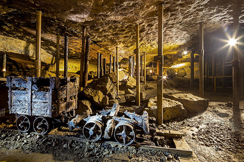
Tarnowskie Góry lead-silver mine and its underground water management system is an exceptional example of a large scale mining network comprising some 50 km of drainage tunnels, over 100 km of access tunnels and excavated chambers and numerous shafts extending over 38 km2. Located in one of Europe’s classic metallogenic provinces it is one of the largest, best preserved and most accessible mine drainage networks in the world.
The monumental system was constructed in technically challenging terrain of highly permeable carbonate strata with unusually high water inflow, in gentle undulating topography with river beds at just slightly lower elevations and with corresponding shallow river gradients. Its effectiveness in water removal was such that the surface distribution of water was permanently altered, the water table was permanently lowered and pre-existing abstraction was rendered obsolete. The mine responded with the adaptation of its technical systems to provide a domestic water supply to the mining town and an industrial water supply to an entire region.
The site is the most significant part of a much larger (150 km2) area exploited for lead-silver ores from the 12th century to the early 20th century. Operations evolved from numerous small-scale artisanal operations to the large-scale industrial concern of Fryderyk Mine that operated from 1784-1910. Underground archaeology reflects a consistent regional hydraulic engineering strategy, begun in the mid-16th century and which adapted with changes in scale and technology over 300 years. Some key surface features and installations are included.
The drainage system is still functioning today and the historic network has been the focus of sustained conservation and public access by a community association since 1957.
Outstanding Universal Value
Tarnowskie Góry lead-silver mine is a property that contains attributes that form a system that is linked in terms of theme, chronology, typology, organisation and socio-economic factors. The boundary of the property, a substantial part of which is underground, is necessary to ensure that the geographical coverage and the overall size is sufficient to provide a complete representation of all the significant attributes that, together, express Outstanding Universal Value. It is the best and most significant system that is representative of a much larger regional group of workings that exploited this classic European metallogenic province.
One of the largest, best preserved and most accessible mine drainage networks in the world
Comparisons with other properties on the World Heritage List and with properties on State-Parties’ Tentative Lists highlight that Tarnowskie Góry lead-silver mine and its underground water management system is a prime example of the peak of the application of mine adit drainage technology developed within European mining culture. The combination of Tarnowskie Góry’s large scale gravitational mine water drainage system, and its function that developed as a regional domestic and industrial water supply, is an exemplar of the sustainable way in which man adapted the exploitation of natural resources.
Tarnowskie Góry lead-silver mine and its underground water management system is one of the largest, best preserved and most accessible mine drainage networks in the world. The only other directly comparable system identified is the Great County Adit in the Cornwall and West Devon Mining Landscape World Heritage Site (UK).
Source: UNESCO | Polish Tourism Organisation
Photo © Szymon Polański/ Polish Tourism Organisation


